Seismiles
Country: Argentina 🇦🇷
País: Argentina 🇦🇷
Страна: Аргентина 🇦🇷
Video VideoВидео
Overview
This itinerary focuses on the strongest part of Catamarca: the Seismiles corridor from Fiambalá / Tinogasta.
Why go:
- paved high-Andes road with views of multiple 6000 m volcanoes
- Balcón del Pissis as one of the most dramatic drive-up viewpoints in Argentina
- hot springs and desert scenery at much lower cost than many southern Argentina routes
This is not a trekking itinerary. It is a road-based, excursion-based high-altitude trip.
Altitude progression is gradual if you follow this order: Catamarca city (~500 m) → Tinogasta (~1,200 m) / Fiambalá (~1,500 m) → Termas (~1,750 m) → Seismiles / Pissis viewpoints (4,700 m+, short exposure only).
Province: Catamarca
Overall time: 5–6 days
Main focus: high-altitude landscapes, volcano viewpoints, lagoons, desert scenery
Best season: March–May, September–November

Arrival – Catamarca city ▾
Arrive in San Fernando del Valle de Catamarca.
Why stay the night:
• keeps the route calm and avoids starting the mountain transfer after arrival
• gives you one low-altitude night before moving west
What to do:
• short walk in the compact center
• cathedral / main square / pedestrian streets
Transfer to Fiambalá or Tinogasta ▾
Move west to the Seismiles gateway area.
How to get there:
• long-distance bus
• private or shared transfer
Where to base:
• Fiambalá – best for Termas and the classic Seismiles departures
• Tinogasta – more services and accommodations, but less convenient for daily excursion logistics
Arrival day:
• short walks
Fiambalá – Termas + sand dunes ▾
Use this as a calm preparation day before the highest road.
Termas de Fiambalá:
• short transfer from town
• multiple thermal pools at different levels
• half day activity
Optional easy add-ons near Fiambalá:
• local dunes / sand scenery
• Ruta del Adobe stops for culture and mountain backdrop
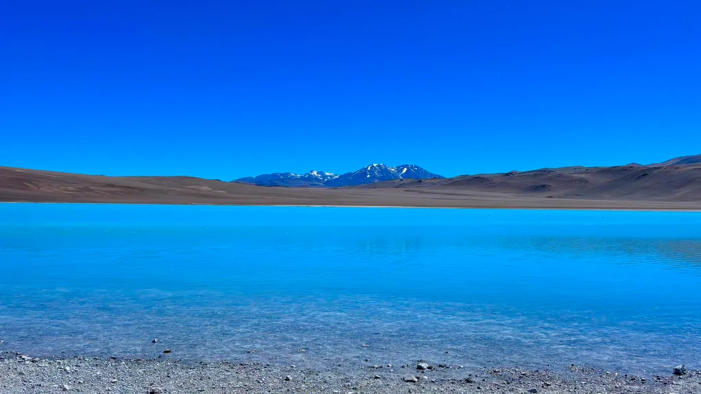
Balcón del Pissis & Ruta de los Seismiles ▾
This is the strongest day of the itinerary.
What it is:
• a very high panoramic balcony over colored lagoons and one of the highest volcanic landscapes on Earth
Altitude:
• above 4,700 m
How the day usually works:
• early 4x4 departure
• scenic drive with multiple stops
• limited time at the highest viewpoint due to altitude and weather
Return to Catamarca city ▾
Return from Fiambalá / Tinogasta the same way:
• bus
• private or shared transfer
If you have a same-day flight:
• leave a large buffer
• road and bus timing can shift
Connections
Inside Argentina (busses):
- combines well with Salta & Jujuy for a second high-altitude region
- La Rioja can be added
- strong Córdoba connections
Useful links
Ruta de los Seismiles:
Balcón del Pissis:
Termas de Fiambalá:
Dunes:
Bus planning: