Uyuni & Southwest Altiplano
Country: Bolivia 🇧🇴
País: Bolivia 🇧🇴
Страна: Боливия 🇧🇴
Video VideoВидео
Overview
This route crosses the remote Southwest Altiplano from San Pedro de Atacama to Uyuni.
The Salar de Uyuni is the final highlight, but the first two days are equally important: colored lagoons, volcano views, geothermal fields, thermal pools, rock formations, flamingos, and almost empty high-altitude desert.
The route is tour-based by design. There is almost no public transport between the natural sites, roads are mostly unpaved, fuel and repair facilities are extremely limited, and accommodation is concentrated in a few remote settlements. A shared or private 4×4 tour is the practical way to travel through this region.
This is better suited to experienced travelers who are comfortable with:
• long 4×4 driving days
• basic accommodation
• very cold nights
• limited facilities
• rapid travel above 4,000 m
Before starting from Chile, spend several nights acclimatizing in San Pedro de Atacama.
Region: Southwest Bolivia / Potosí
Overall time: 3 days one-way San Pedro → Uyuni; 4 days if returning to San Pedro
Main focus: volcanoes, colored lagoons, Altiplano desert, wildlife, Salar de Uyuni
Best overall season: September–November for dry roads and less severe cold than midwinter

Day 1 – San Pedro → Eduardo Avaroa Reserve → Villamar ▾
This is the largest altitude jump of the route and one of its strongest landscape days.
Route:
• Early pickup in San Pedro de Atacama
• Minibus to the Chile–Bolivia border
• Immigration at Hito Cajón
• Change to Bolivian 4×4 vehicle
• Full day through the Eduardo Avaroa Reserve
• Night around Villamar
Altitude:
• San Pedro de Atacama: ~2,400 m
• Border: ~4,400–4,600 m
• Laguna Verde: ~4,310 m
• Sol de Mañana: ~4,900 m
• Laguna Colorada: ~4,280 m
• Villamar: ~3,900 m
Main stops:
Laguna Blanca:
• Pale mineral lagoon immediately below Licancabur Volcano
• First major landscape after crossing into Bolivia
Laguna Verde:
• Green / turquoise saline lagoon
• Direct view toward the volcanic cone of Licancabur
Desierto Salvador Dalí:
• Open volcanic desert with isolated rock formations and mountains
• Almost no vegetation or settlements
Termas de Polques:
• Natural thermal pools in the middle of the Altiplano
• Usually possible to swim before continuing higher
Sol de Mañana:
• Geothermal field with fumaroles, steam vents, and boiling mud
• Highest point normally reached during the standard route
Laguna Colorada:
• Large shallow red-pink lagoon colored by minerals and microorganisms
• One of the main flamingo areas in the reserve
Night:
• Villamar or nearby settlement
Day 2 – Villamar → Rock Formations → Salar Region ▾
The second day moves north through more isolated desert and geological landscapes toward the Salar de Uyuni.
Altitude:
• Most of the route remains around ~3,700–4,200 m
• Night near the Salar: roughly ~3,650–3,750 m
The exact route varies more between operators than on Day 1.
Common stops include:
Valle de las Rocas / Italia Perdida:
• Large volcanic rocks shaped by erosion
• Some formations resemble towers, animals, or abandoned stone structures
Laguna Negra / Vinto or similar small lagoons:
• Darker, quieter lagoons surrounded by volcanic terrain
• Usually much smaller and less visited than Laguna Colorada
Cañón de la Anaconda:
• Viewpoint over a narrow winding river and wetland below
Altiplano wetlands:
• Green areas in an otherwise dry landscape
• Common places to see llamas and vicuñas
Night:
• Salt hostel or similar accommodation near Colcha K / the southern edge of the Salar
Why this day matters:
• The landscapes change from high volcanic lagoons to rock formations and finally the open Salar region
• Tourist traffic is generally much lower than around the salt flat itself
Day 3 – Salar de Uyuni & Uyuni ▾
The final day crosses the Salar de Uyuni and finishes in Uyuni town.
Altitude:
• Salar de Uyuni: ~3,650 m
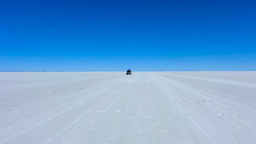
Salar de Uyuni:
• Largest salt flat in the world
• Vast white salt surface surrounded by distant volcanoes and mountains
Dry season:
• White salt crust
• Hexagonal salt patterns
• Full access across much more of the Salar
Rainy season:
• Shallow water can create the famous mirror effect
• Access routes change depending on flooding
Isla Incahuasi:
• Rocky island covered with giant cacti
• Elevated viewpoint over the Salar
• Usually accessible in the dry season
• May be inaccessible when the Salar is flooded
Other common stops:
• Salt polygons and perspective-photo areas
• Isla de las Banderas / Dakar monument
• Colchani – salt processing and small craft market
• Train Cemetery outside Uyuni
Finish:
• Standard 3-day one-way tours normally reach Uyuni in the afternoon
If continuing through Bolivia:
• End the tour here and stay in Uyuni or continue onward
If returning to Chile:
• The 4-day version continues south after Uyuni and spends the third night around Villamar again
Day 4 – Return to San Pedro (4-day tours only) ▾
This day only applies if you booked the San Pedro → Uyuni → San Pedro loop.
Route:
• Early departure from Villamar
• Drive back toward Hito Cajón
• Bolivia / Chile immigration
• Change from 4×4 to Chilean transfer vehicle
• Return to San Pedro de Atacama
There are normally no major sightseeing stops on this day.
Why choose the return route:
• Your flights and accommodation remain in Chile
• You do not want to continue through Bolivia
Tour format and accommodation
Standard shared tours:
- Usually use Toyota Land Cruiser or similar 4×4 vehicles
- Common configuration is up to 6 passengers plus the driver
- Meals and overnight accommodation are normally included
- Park entrances, thermal pools, and some smaller fees may be paid separately in cash
Accommodation:
- The first night around Villamar is usually the most basic
- Standard rooms may have no room heating even when outside temperatures fall below freezing
- Hot water, showers, electricity, and charging can be limited or available only at specific times
- The second night near the Salar is often somewhat better, especially in salt hostels
The landscapes are the reason to take this route; accommodation should be treated as functional overnight shelter.
Starting from La Paz instead
Uyuni can also be reached from La Paz.
La Paz → Uyuni:
- Direct BoA flight: about 1 hour
- Overnight bus: roughly 9–10 hours
Current direct flights from Uyuni operate to La Paz, making this the simplest air connection for continuing through Bolivia.
Altitude:
- Central La Paz: ~3,650 m
- El Alto airport: ~4,060 m
Tour choice matters:
- A 1-day Uyuni tour mainly covers the Salar, Colchani, and nearby sights
- A 3-day tour from Uyuni includes the southern Altiplano, colored lagoons, deserts, volcano viewpoints, and geothermal areas
- The 3-day route can finish back in Uyuni or continue across the border to San Pedro de Atacama
For this itinerary, San Pedro → Uyuni is preferable because the route naturally starts with the most remote southern landscapes and finishes with the Salar.
Continuing from Uyuni
Uyuni has useful onward connections, but it is not a major transport hub.
La Paz:
- Direct BoA flight
- Direct overnight buses
Potosí:
- Regular buses
- Useful if continuing through southern / central Bolivia
Sucre:
- Direct overnight buses operate
- Another option is Uyuni → Potosí → Sucre
Tupiza / Villazón:
- Bus connections are available
- Useful if continuing south toward Argentina
There are currently no useful direct international flights from Uyuni; La Paz is the main air connection.
Best season
September–November:
- Best overall balance for this full route
- Mostly dry roads
- Good access across the Salar
- Less severe cold than June–August
- Nights at Villamar can still fall below freezing
December–March:
- Warmer than winter
- Best chance of the Salar mirror effect, especially January–February
- Rain can change the route
- Isla Incahuasi and some Salar crossings may become inaccessible
May–August:
- Driest and most predictable road conditions
- Clear skies
- Full dry-salt-flat landscapes
- Coldest period, especially at the first-night accommodation and before sunrise
There is no single best season: choose September–November for the most balanced expedition, or the rainy season if the mirror effect is the priority.
What to bring
Bring:
- Bolivianos in cash for park entrances and small local payments
- Very warm layers, including gloves and hat
- Small day bag for items needed inside the 4×4 (large luggage normally travels on the roof of the 4×4 under a protective cover)
- Water, sunscreen, sunglasses, and lip protection
- Swimsuit and towel if using the thermal pools
Useful links
Protected areas:
- Bolivia SERNAP: https://www.sernap.gob.bo/
Buses:
-
Uyuni → La Paz schedules / booking: https://www.ticketsbolivia.com.bo/pasajes-en-bus/uyuni-la_paz.php